Trail Walking Le Lorrain - Boucle Seguineau 22 Mai - Photo

Boucle Seguineau 22 Mai

 Lamartiniere
Lamartiniere

User GUIDE

© OpenStreetMap contributors
Length
Length
14.2 km
Max alt
Max alt
232 m
Uphill gradient
Uphill gradient
370 m
Km-Effort
Km-Effort  
19.2 km
Min alt
Min alt
5 m
Downhill gradient
Downhill gradient
371 m
Boucle
Boucle
Yes
Creation date :
2022-05-13 10:08:14.353
Updated on :
2022-05-16 20:20:35.105

(0 Reviews)

Walking
Walking
4h00
Difficulty : Very difficult

Scan this QR Code to open this trail in the SityTrail application

FREE GPS app for hiking

Logo SityTrail SityTrail

IGN / Geographical institutes

Download SityTrail from the App Store Download SityTrail from Google Play

Logo SityTrail SityTrail World

The world is yours!

Download SityTrail from the App Store Download SityTrail from Google Play Download SityTrail on Huawei AppGallery

About

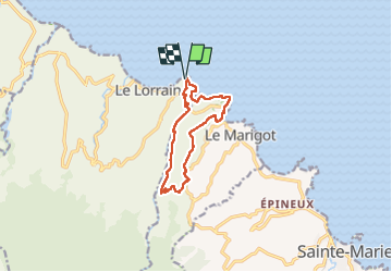
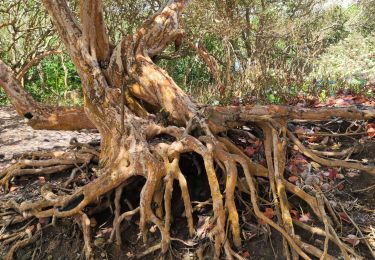
Trail Walking of 14.2 km to be discovered at Martinique, Unknown, Le Lorrain. This trail is proposed by Lamartiniere.

Description

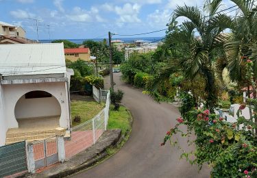
Randonnée en boucle à partir du quartier Séguineau et  en partie sur terrains privés, par conséquent,  deux demandes d'autorisations de passage.
Première demande  accompagnée de l'assurance de l' Association pour l' exploitation agricole Dehaumont.
Deuxième demande faite à l'amiable auprès d'un particulier du Marigot.
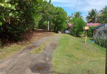
Traversée de la N1 au niveau du port de pêche du Marigot.
Utilisation du SLNA  pour la deuxième partie de la rando et utilisation du "pont de singe" au niveau du restaurant  Pôl Nord. Randonnée  pas difficile, j'ai oublié de cliquer sur Moyen.

Elevation profile

Photos

Positioning

Country:
France
Region :
Martinique
Department/Province :
Unknown
Municipality :
Le Lorrain
Location:
Unknown
Start:(UTM)
710518 ; 1641083 (20P) N.

Trails nearby

Trail Walking Le Marigot - Boucle Le Mariigot - Charpentier - SLNA. - Photo
Walking
GUIDE
Lamartiniere

Walking

Medium
(1)
Le Marigot, Martinique, Unknown, France
8.7 km | 12.8 km-effort
3h 0min
Yes
Trail Walking Le Marigot - Reco Rando Marigot  - Photo
Walking
GUIDE
manuelPerez

Walking

Le Marigot, Martinique, Unknown, France
7.1 km | 10.3 km-effort
3h 6min
Yes
Trail Walking Le Marigot - Marigot vers le Lorrain - Photo
Walking
GUIDE
GabyG

Walking

Medium
Le Marigot, Martinique, Unknown, France
4.8 km | 6.5 km-effort
2h 1min
No
Trail Walking Le Lorrain - Morne Jacob au Panneau ONF - Photo
Walking
GUIDE
Lamartiniere

Walking

Medium
Le Lorrain, Martinique, Unknown, France
4.3 km | 8.7 km-effort
2h 0min
No
Trail Walking Le Lorrain - trace des Amérindiens - Photo
Walking
GUIDE
GabyG

Walking

Medium
Le Lorrain, Martinique, Unknown, France
5.1 km | 6.6 km-effort
2h 40min
No
Trail Walking Le Lorrain - Boucle La Crabiere - Hbt Assier - Photo
Walking
GUIDE
Lamartiniere

Walking

Medium
Le Lorrain, Martinique, Unknown, France
8.5 km | 11.7 km-effort
3h 0min
Yes
Trail Walking Basse-Pointe - Stèle Anse  Chalvet - Boulodrome Basse-Pointe  - Photo
Walking
GUIDE
Lamartiniere

Walking

Medium
Basse-Pointe, Martinique, Unknown, France
3.3 km | 4.1 km-effort
2h 57min
No
Trail Walking Le Lorrain - Boucle Seguinrau via Le Marigot - Photo
Walking
GUIDE
Lamartiniere

Walking

Difficult
Le Lorrain, Martinique, Unknown, France
10.2 km | 13.7 km-effort
3h 30min
Yes
Trail Walking Le Lorrain - Boucle Prébour -- Carabin - Photo
Walking
GUIDE
Lamartiniere

Walking

Difficult
Le Lorrain, Martinique, Unknown, France
15.5 km | 24 km-effort
4h 30min
Yes


Close
My subscriptions